New Web Project Traces Every Waterway in Contiguous U.S.
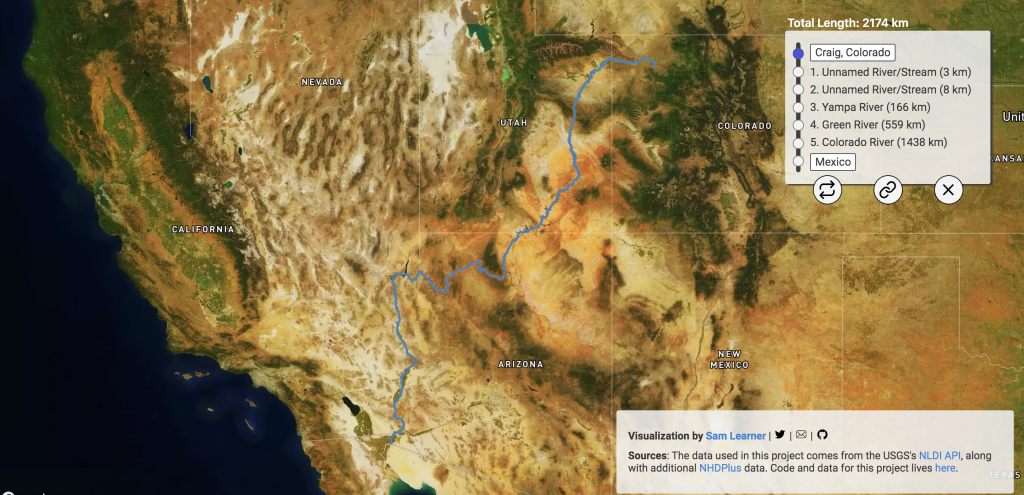
Calling all river-lovers and map enthusiasts! A new web project called River Runner, created by data analyst Sam Learner, allows you to follow the path of a raindrop anywhere in the contiguous United States. Using data from the United States Geological Survey, Learner mapped the flow of water throughout all 48 adjoining states. Just click on any spot on the map to create your raindrop and watch it flow downstream.
We are excited about this tool because it provides you with a bird’s eye view of the river and its surroundings. Landmarks such as lakes and major mountains are marked, and the degree of detail and vertical distance from the river is flexible, which means you control the detail. Depending on where you begin your journey, you can start on an unnamed stream or a small river, or you might jump right on to the path of a major river.
Here are some trips we suggest trying out:
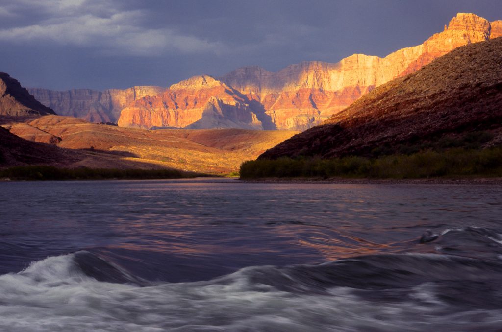
Follow the Colorado River
As you trace the path of the Colorado, you’ll notice many of the country’s famous natural wonders. The River Runner website shows the river’s nearby topography, and you’ll see it flow alongside mountains, mesas, and canyon walls. Look down on the river flowing through the Grand Canyon or farther north, and you’ll see it flow through other National Parks, including Rocky Mountain and Canyonlands.
As you watch its course, keep in mind that even a grand river has its limits. Demand for the Colorado River’s water is exceeding its supply. Seven different states rely on water from the Colorado, but its usage is unsustainable. While watching it flow virtually, consider how essential it is that we take measures to ensure it does not dry up.
Follow the Snake River
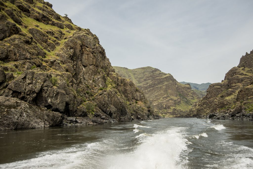
Using River Runner you’ll encounter the Snake River, a tributary of the Columbia River, predominantly in Idaho, but also in Wyoming, Oregon, and Washington.
Along the Snake River, you’ll notice several dams. These include the Little Goose and Ice Harbor Dams. While the river continues to flow through them, unfortunately migratory fish face each of the dams as a barrier, preventing them from moving freely to their natural spawning grounds. A high proportion of juvenile salmon are killed in their attempts to swim downstream. As you follow the Snake River’s path, consider the benefits of making this a truly free-flowing river.
Follow the Mississippi River
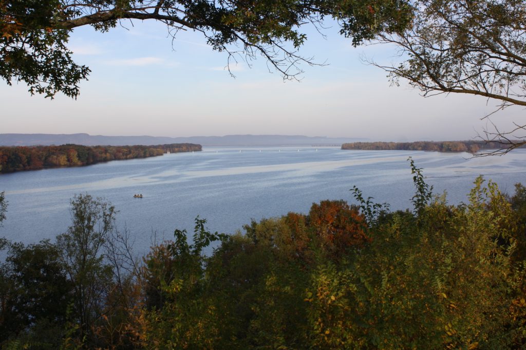
You can start your path on the lengthy Mississippi from an incredible number of places, as it flows through ten states and drains 41 percent of the continental U.S. In fact, if you’re in the mood to explore, you’ll notice that to follow the Mississippi’s route downstream, you don’t need to start all that close to the river itself. Waterways as far away as Montana and Pennsylvania will ultimately drain into the Gulf of Mexico via the Mississippi.
While watching the Mississippi’s path, think about the changes the river has undergone over its history. Throughout the 1900s, wetlands and other floodplain ecosystems were drained and cut off from the river. This immensely degraded the habitat of native species and made flooding far more dangerous. Restoring the river’s natural floodplains is crucial moving forward.
These are just a few examples of the literally thousands of possible water sources you can start with. What the website makes abundantly clear is the extent to which our waterways are linked, demonstrating that the problems facing one body of water will seldom remain exclusive to it. This impact was intentional.
Learner explained, “What I really hope people take away from the tool, besides a fun visual experience, is just how interconnected our waterways are, and the implications of that in terms of pollutants, agriculture, or water use.”
We encourage you to try out the tool, and whether you want to see where the water in your own backyard goes, want to trace the banks of mighty rivers, or even seek to develop conservation strategies, we know you will learn something about how water runs through the country.
The post New Web Project Traces Every Waterway in Contiguous U.S. appeared first on American Rivers.