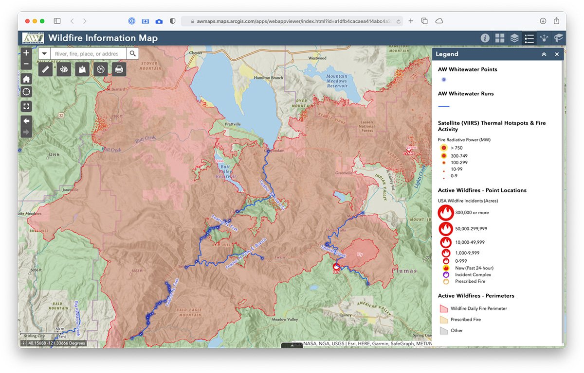
AW Wildfire Info Map Keeps Boater Updated on Rivers Affected by Fires
 It’s become increasingly clear in recent years that wildfires are becoming more frequent, larger, and longer-lasting. Many areas of the country have been affected, particularly the West and this includes our whitewater rivers and their watersheds. Until recently, there hasn’t been a way for whitewater enthusiasts to easily view active wildfires and rivers on a single map and it has been difficult to see the big picture view of what fires are affecting our rivers.
Now, the AW Wildfire Information Map brings together AW’s National Whitewater Inventory with the latest wildfire info on a single map. Be sure to check in with this map if you’re planning a visit to a river in an area that may be currently affected by wildfires, or if you’re just curious about the current status of wildfires and their relationship to whitewater rivers.
In addition to river info and fire locations, the map has optional data layers for smoke and air quality info, live AlertWildfire webcams, past fire history, and more. Maps can be easily shared, customized and printed, and other tools allow measurements, drawing, and more. Click the (i) button in the top-right blue header for complete instructions.
By Scott Harding