Boundary P-2144
General information | |
| Waterway |
Pend Oreille River |
| Current status | Active license |
| Type of facility | Conventional Hydro |
| Mode of hydropower generation | Peaking |
| Type of permit | FERC License |
FERC information | |
| FERC docket # | P-2144 |
| FERC project name | Boundary |
| Permit issued | 3/15/13 |
| Permit expiration | 2/24/55 |
Ownership and operation | |
| Owner | Seattle City of |
| Owner type | Publicly Owned Utility |
| Year first online (conventional hydro) | 1967 |
| Transmission or distribution system owner | Bonneville Power Administration |
Power and generating capacity | |
| Number of units | 6 |
| Total capacity from hydraulic turbine-generator units within each plant | 1,118.6 MW |
| Average annual net hydropower generation | 3,771,540.6 MWH |
Download license summary for the Boundary project.
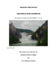
The project is located on the Pend Oreille River near the city of Metaline Falls, in Pend Oreille County, Washington. The project occupies 609.24 acres of federal land managed by the U.S. Department of Agriculture, Forest Service (Forest Service) within the Colville National Forest, and 329.35 acres of federal lands managed by the U.S. Bureau of Land Management (BLM).
The license for this project was issued in conjunction with the license surrender for the Sullivan Creek Project (P-2225) based on the comprehensive settlement provision signed by Seattle City and Light, PUD No. 1 of Pend Orielle County, Washington, resource agencies, tribes, and NGO representatives including HRC members.
The Boundary Project is located at river mile 17 on the Pend Oreille River in a narrow canyon in the Selkirk Mountains in the northeast corner of Washington, about 10 miles north of the city of Metaline Falls and one mile south of the U.S.-Canada border. The Pend Oreille River is about 120 miles long from its origin at Lake Pend Oreille in Albeni Falls, Idaho to its confluence with the Columbia River in British Columbia, Canada. The Pend Oreille River system is highly regulated, with flows controlled by seven hydroelectric and storage projects upstream from Boundary dam, and two in Canada downstream from the project. The project’s reservoir is located immediately downstream of the District’s Box Canyon Project No. 2042. Lands surrounding the project include mostly forest managed by the Forest Service and BLM for multiple uses, as well as some private land used for commercial, recreation, mining, and agricultural production.
(Source: FERC)
Milestones
| License Application Submitted | 09-29-2009 |
| FEIS Issued | 09-09-2011 |
| License Issued | 03-20-2013 |
| Multiparty Settlement Signed | 03-29-2010 |
Is there something you’d like to add or correct? Please let us know.
News and updates
From California Sportfishing Protection Alliance7/17/2024
CSPA Intervenes in Litigation on Drum-Spaulding and Yuba-Bear Hydroelectric Projects
From Hydropower Reform Coalition6/18/2024


