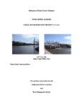
Lay Dam P-2146
General information | |
| Waterway |
Coosa River |
| Current status | Active license |
| Type of facility | Conventional Hydro |
| Mode of hydropower generation | Run-of-river |
| Type of permit | FERC License |
FERC information | |
| FERC docket # | P-2146 |
| FERC project name | Coosa River |
| Other projects with this FERC number | |
| Permit issued | 6/15/13 |
| Permit expiration | 5/27/43 |
Ownership and operation | |
| Owner | Alabama Power Co |
| Owner type | Investor-Owned Utility |
| Year first online (conventional hydro) | 1967 |
| Transmission or distribution system owner | Alabama Power Co |
Power and generating capacity | |
| Number of units | 6 |
| Total capacity from hydraulic turbine-generator units within each plant | 177.0 MW |
| Average annual net hydropower generation | 529,527.8 MWH |
Download license summary for the Coosa project.
Alabama Power Company received an operating license for the Coosa River projects in June 2013 for the following seven developments:
- Weiss, H. Neely Henry (Neely Henry), Logan Martin, Lay, and Bouldin developments (previously Coosa River projects)
- Mitchell (previously Mitchell dam project, P-82), and
- Jordan (previously Jordam dam project, P-618).
The Coosa River Basin drainage encompasses about 10,161 square miles in Alabama, Georgia, and Tennessee. The Coosa River begins at the confluence of the Oostanaula and Etowah rivers in northwest Georgia, and flows 267 miles in a southerly direction to its confluence with the Tallapoosa River, forming the Alabama River.
The Coosa River Basin supports rich and diverse assemblages of aquatic species, with 147 species of fish. Additionally, it supports the most diverse collection of freshwater mollusks in the world.
Milestones
| License Application Filed | 07-28-2005 |
| EA Issued | 04-06-2009 |
| License Issued | 06-20-2013 |
Is there something you’d like to add or correct? Please let us know.
Related posts
- From American Rivers 04/18/22
America’s Most Endangered Rivers of 2022 Spotlights Rivers in Crisis Mode - From Alabama Rivers Alliance 03/21/13
Damming of Alabama’s Coosa River Highlighted in International Report
News and updates
From California Trout1/21/2026
From South Yuba River Citizens League1/21/2026
The PERMIT Act Passed the House: What It Means for the Yuba River Watershed

