Clearwater 1 P-1927
General information | |
| Waterway |
North Umpqua River |
| Current status | Active license |
| Type of facility | Conventional Hydro |
| Mode of hydropower generation | Peaking |
| Type of permit | FERC License, FERC |
FERC information | |
| FERC docket # | P-1927 |
| FERC project name | North Umpqua |
| Other projects with this FERC number | |
| Permit issued | 11/13/03 |
| Permit expiration | 10/27/38 |
Ownership and operation | |
| Owner | PacifiCorp |
| Owner type | Investor-Owned Utility |
| Transmission or distribution system owner | PacifiCorp |
Power and generating capacity | |
| Number of units | 1 |
| Total capacity from hydraulic turbine-generator units within each plant | 15.0 MW |
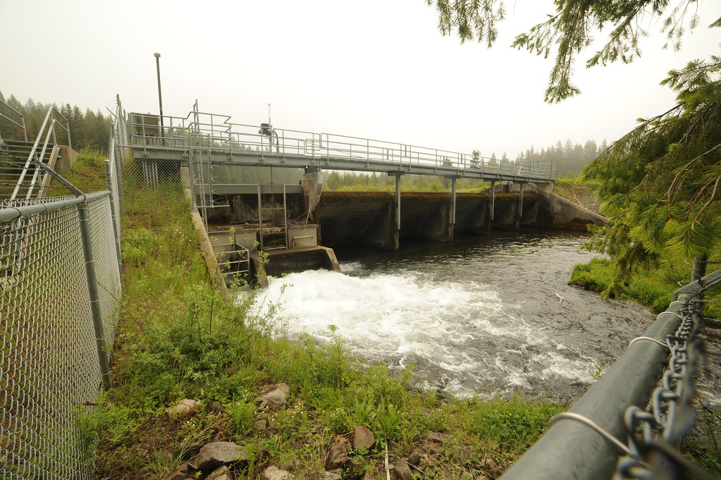
The North Umpqua Project was constructed between 1947 and 1956. It consists of a series of dams and canals that divert water to the eight developments, each of which has a powerhouse and a dam. The Clearwater No. 1 Development is the uppermost development on the Clearwater River, which has its confluence with the North Umpqua River near Toketee dam. The development includes a 17-foot-high diversion dam located about 8.1 miles upstream of Toketee Lake and impounding 11.8-acre Stump Lake, 13,037 miles of canal and flumes extending from Stump Lake dam to the forebay, a 16.3-acre forebay with total maximum storage capacity of 120.8 acre-feet, a 4,863-foot-long penstock, and a powerhouse with a single turbine-generator having a rated capacity of 15,000 kW. The powerhouse discharges directly into the Clearwater No. 2 diversion.
Is there something you’d like to add or correct? Please let us know.
Related resources
News and updates
From California Trout1/21/2026

From South Yuba River Citizens League1/21/2026
The PERMIT Act Passed the House: What It Means for the Yuba River Watershed