Toketee P-1927
General information | |
| Waterway |
North Umpqua River |
| Current status | Active license |
| Type of facility | Conventional Hydro |
| Mode of hydropower generation | Peaking |
| Type of permit | FERC License |
FERC information | |
| FERC docket # | P-1927 |
| FERC project name | North Umpqua |
| Other projects with this FERC number | |
| Permit issued | 11/13/03 |
| Permit expiration | 10/27/38 |
Ownership and operation | |
| Owner | PacifiCorp |
| Owner type | Investor-Owned Utility |
| Year first online (conventional hydro) | 1949 |
| Transmission or distribution system owner | PacifiCorp |
Power and generating capacity | |
| Number of units | 3 |
| Total capacity from hydraulic turbine-generator units within each plant | 42.6 MW |
| Average annual net hydropower generation | 216,532.6 MWH |
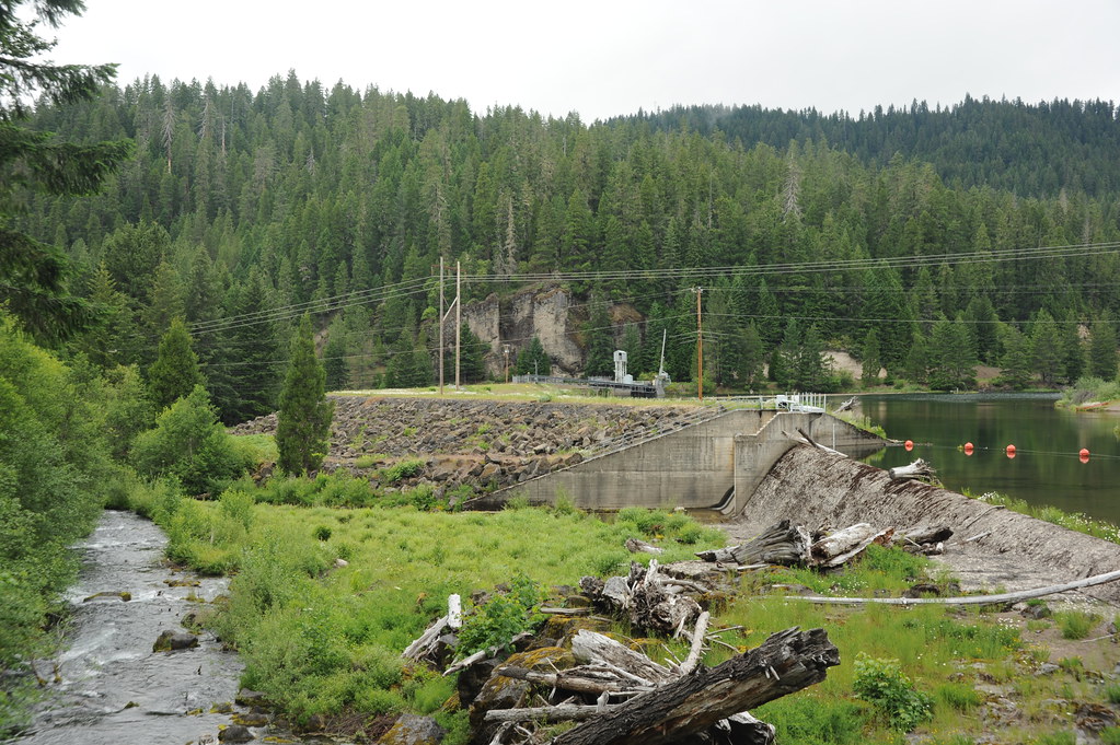
The North Umpqua Project was constructed between 1947 and 1956. It consists of a series of dams and canals that divert water to the eight developments, each of which has a powerhouse and a dam. The Toketee Development, located at the confluence of the Clearwater and North Umpqua Rivers, includes a 58-foot-high embankment dam on the North Umpqua that impounds the 96.9-acre Toketee Lake (with a total maximum storage capacity of 1,051acre-feet), 6,994 feet of pipe and tunnel extending from Toketee dam to the penstock, a single 1,067-foot-long penstock that splits into three approximately 158-footlong sections near its downstream end, and a powerhouse with three turbine-generators having a combined installed capacity of 42,500 kW. The powerhouse is located on the North Umpqua approximately two miles downstream of Toketee Lake, which serves as the forebay for the development and provides active storage to regulate flow through the powerhouse.
Is there something you’d like to add or correct? Please let us know.
Related resources
News and updates
From California Trout1/21/2026
From South Yuba River Citizens League1/21/2026
The PERMIT Act Passed the House: What It Means for the Yuba River Watershed